 |
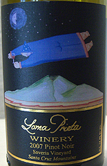
Loma Prieta Winery |
Map
This winery’s map location has been determined using Geocoding Mapping Technology, based on winery address data. If you plan to visit Loma Prieta Winery, please contact the winery to confirm location.
Visiting the Winery
From Highway 17 North
¦Take the Summit Road exit.
¦Stay on Summit Road (heading East) for about 6 miles, until you come to the 1st and only stop sign. Summit Rd will change names during this to Highland Way, but don’t worry about looking for street names; stay on the main road. During the course of this 6 miles you will pass the Loma Prieta School, Burrell School Winery, Summit Store, Soquel-San Jose Road and the Fire Station. When you see Radonich Ranch on your right, you are almost to the stop sign.
¦At the stop sign, the road splits. Take the road to the left, called Mt. Bache. Go 1.5 miles on Mt. Bache, and you will see us on the left. Mt. Bache changes names to Loma Prieta WAY during the course of this 1.5 miles. Warning: Do NOT turn left onto Loma Prieta AVE.
From Highway 17 South
¦Take the Summit Road exit.
¦Follow the exit as it loops around to the right and crosses back over the freeway, and you immediately come to a stop sign.
¦At this stop sign you must turn Left onto Summit Road. If you turned right, it would put you right back on Highway 17 North.
¦Stay on Summit Road (heading East) and follow the directions as listed above.


 Have Clippers, Will Travel:
 Pinotphiles enjoy a taste of Paradise